National Geographic
Pacific Crest Trail Great Treks Planning Map by National Geographic
Pacific Crest Trail Great Treks Planning Map by National Geographic
Couldn't load pickup availability
Share
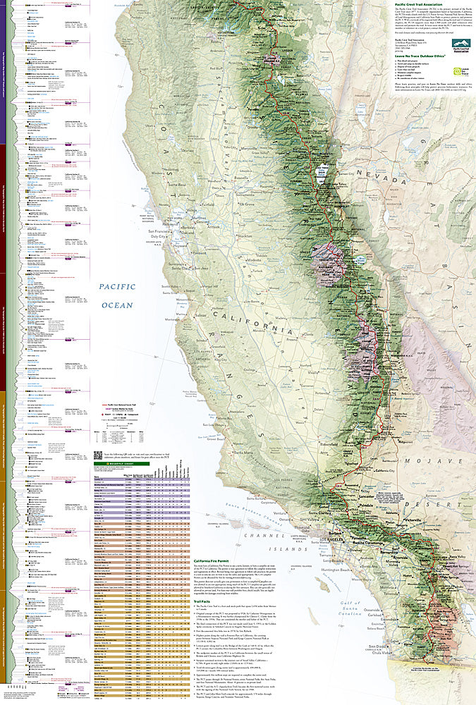
Dreaming of big miles and wild horizons? This is the map that turns Pacific Crest Trail dreams into a dialed-in plan. Built for hikers who love details as much as dirt under their boots, this overview map makes the entire P.C.T. feel achievable.
The Pacific Crest Trail stretches 2,650 legendary miles from the Canadian border to Mexico, cutting through Washington, Oregon, and California. Along the way it passes icons like Mount Rainier National Park, Crater Lake, and Yosemite, while traversing the volcanic Cascade Range, the granite spires of the Sierra Nevada, and the stark beauty of the Mojave Desert. First conceived in the 1930s and completed decades later, the P.C.T. is one of America’s most ambitious long-distance trails.
National Geographic’s Great Treks Planning & Overview Map #5001 displays the full trail with towns, roads, section markers, and critical waypoints. Detailed charts break down mileage, elevation gain, slope, and high and low points, while resupply tables simplify logistics for section hikes or full thru-hikes. Printed on Backcountry Tough waterproof paper with a full lat/long grid, this map is ready for real trail life—from couch planning to summit views.
SKU: SKU:TRA5001
View full details