Custom Correct
Ozette Beach Loop Trail Map
Ozette Beach Loop Trail Map
Couldn't load pickup availability
Share
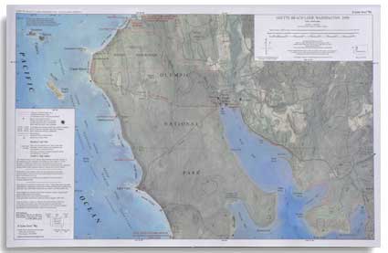
The Ozette Beach Loop Trail Map by Custom Correct is the perfect guide for exploring one of Olympic National Park’s most iconic coastal hikes. Focused on the stunning Ozette - Cape Alava - Sand Point Loop, this map covers the north end of Ozette Lake, the rugged beauty of Cape Alava (the westernmost point in Washington) and the scenic shoreline of Sand Point.
Featuring a striking full-color aerial photo from 2006 with detailed overlays, the 1:24,000 scale ensures unmatched clarity, matching USGS 7.5-minute quads for precision. It also includes the Ozette Reservation and the historic site of the famous "Ozette Dig."
Whether trekking through lush coastal forests or strolling along windswept beaches, this map is an essential tool for your journey.
SKU: SKU:LREOBL
View full details