Mitchell Geography
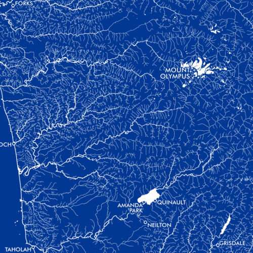
Olympic Peninsula Rivers / Hydrology Map
Olympic Peninsula Rivers / Hydrology Map
Couldn't load pickup availability
Share
Dive into the wild beauty of Washington’s Olympic Peninsula with this striking Olympic Peninsula Rivers / Hydrology Map! Designed in a bold blue monochrome graphic art style, this eye-catching print instantly transforms any wall into a conversation piece for map lovers, hikers, anglers, and Pacific Northwest adventurers.
Printed on heavy fine paper in a versatile 13" x 19" format, this detailed hydrology map highlights the peninsula’s intricate network of rivers, waterways, and populated places for easy reference. From the legendary Hoh Rain Forest to the rugged coastline of Olympic National Park, the map captures one of America’s most geographically diverse landscapes. The Olympic Peninsula itself was once largely isolated by mountains and dense forests, helping preserve its untamed wilderness and rich ecosystems for generations.
Perfect as map décor, travel memorabilia, or educational geographic art, this Olympic Peninsula hydrology print blends scientific beauty with Pacific Northwest charm. A fantastic gift for outdoor enthusiasts, history buffs or anyone captivated by Washington’s river systems and dramatic coastal terrain.
SKU: SKU:PMGWAOP01
View full details