The MapShop
Olympic National Park Raised Relief Map
Olympic National Park Raised Relief Map
Couldn't load pickup availability
Share
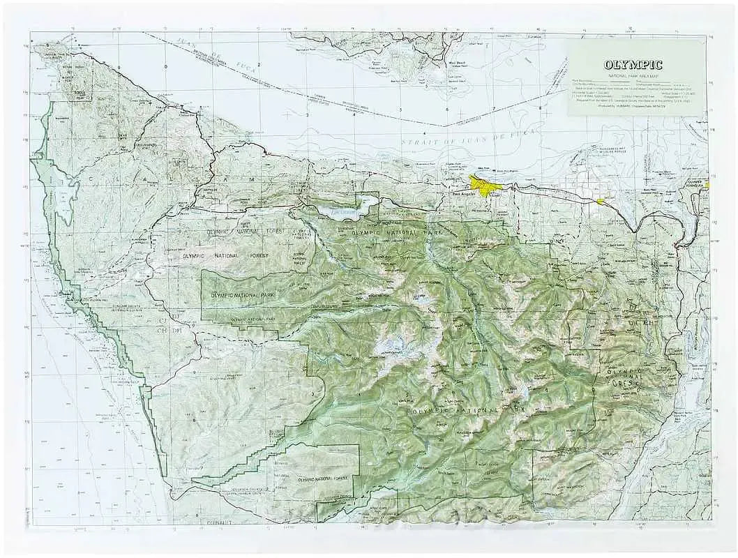
Olympic National Park Raised Relief Map: Explore the rugged beauty of the Pacific Northwest with your very own Olympic National Park Raised Relief Map. This carefully crafted map captures the diverse landscapes of one of America's most unique national parks, bringing its breathtaking topography to life. Whether you're a seasoned hiker, a geography enthusiast, or a lover of natural wonders, this map offers a stunning visual and tactile representation of Olympic National Park's most iconic features.
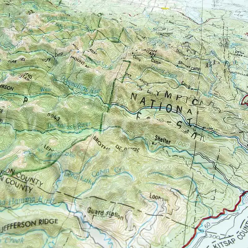
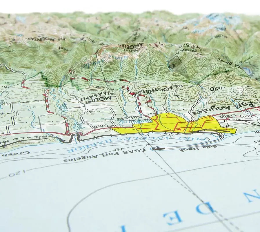
Olympic National Park Raised Relief Map Peaks & Ranges: Olympic National Park is home to some of the most dramatic peaks in the Pacific Northwest, and this raised relief map highlights them in stunning detail. The mighty Mount Olympus, standing at 7,980 feet, dominates the landscape as the tallest peak in the park. Surrounding it, the Olympic Mountains form a spectacular range with other notable summits like Mount Carrie and Mount Constance. Each peak is precisely labeled, allowing you to trace the rugged contours of these majestic mountains as they rise from the map.
Olympic National Park Raised Relief Map Geographic Features: Beyond its towering mountains, Olympic National Park boasts a remarkable array of geographic features that make it a place of unparalleled natural beauty. This map intricately depicts the park's rivers, including the Hoh, Elwha, and Quinault, which carve through ancient rainforests and glacial valleys. Lakes such as Crescent Lake and Quinault Lake are also clearly labeled, reflecting the park's diverse aquatic landscapes. The map captures the dense forests, lush valleys, and sweeping coastlines, offering a comprehensive view of the park's varied ecosystems.
** Raised Relief Maps are printed on vinyl and are not intended to roll and/or fold. We ship them in a flat box and pack them with love (i.e. Plenty of bubble wrap!) **
SKU: SKU:TMSNPOLYMPIC
View full details