Rand McNally
Oklahoma State Highway Folded Map by Rand McNally - Easy to Read
Oklahoma State Highway Folded Map by Rand McNally - Easy to Read
Couldn't load pickup availability
Share
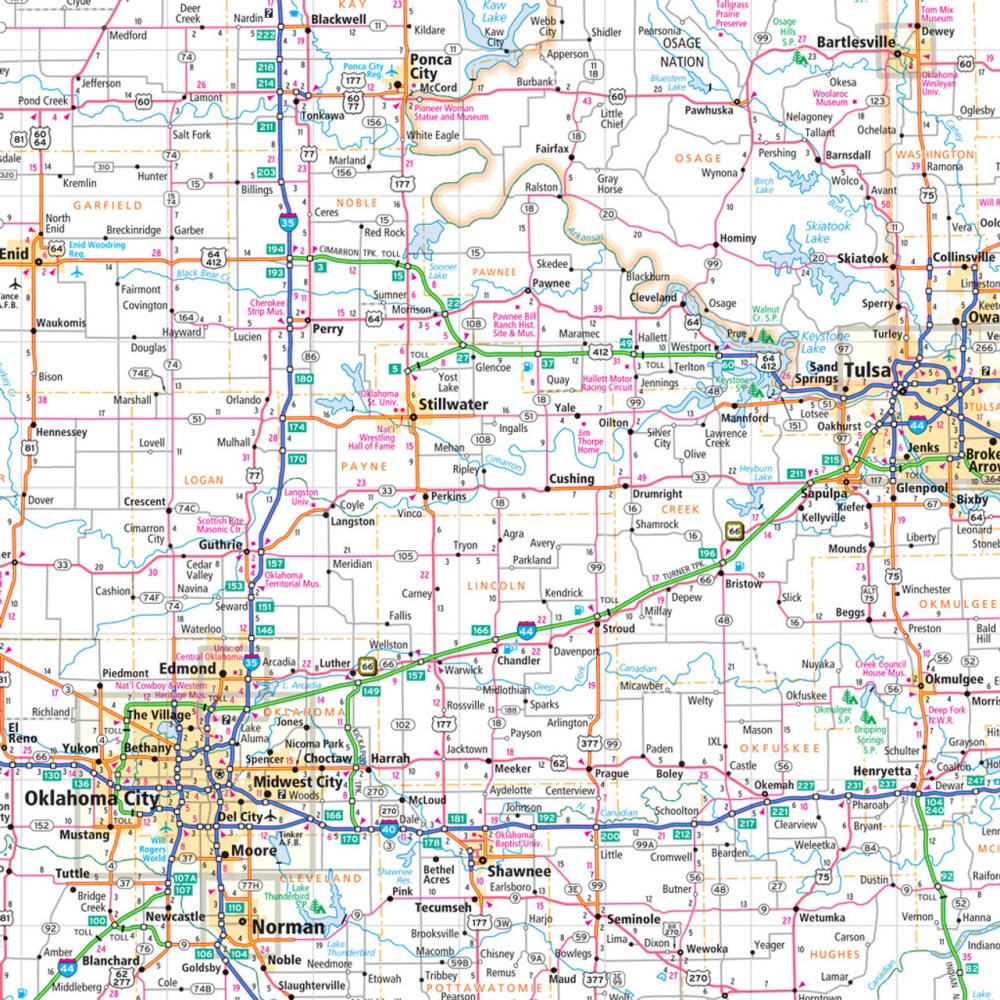
Hit the road and explore the "Sooner State" like never before with the Oklahoma State Highway Folded Map by Rand McNally! Whether you’re chasing big city vibes or hidden gems, this easy-to-read map is your ultimate travel companion, giving you the confidence to navigate every turn and twist without relying on your phone. Known for its cowboy heritage and friendly charm, Oklahoma is full of surprises—from bustling Oklahoma City to lesser-known treasures like the Wichita Mountains Wildlife Refuge, a must-see destination for wildlife lovers and scenic vistas.
Rand McNally’s Easy To Read State Folded Map delivers unmatched accuracy and clarity, showing all Interstate, U.S., state, and county highways, plus parks, points of interest, airports, county boundaries, and local streets. The full-color, regularly updated design, larger print, and convenient folded size make it perfect for planning road trips, estimating mileage, and checking driving times. The detailed index and clear legend let you find destinations quickly, ensuring every adventure is smooth and stress-free. Perfect for explorers who value precision, convenience, and a little bit of discovery along the way.
SKU: SKU:RMCUSOK
View full details