National Geographic
Okefenokee National Wildlife Refuge Trails Illustrated Topo Map #795
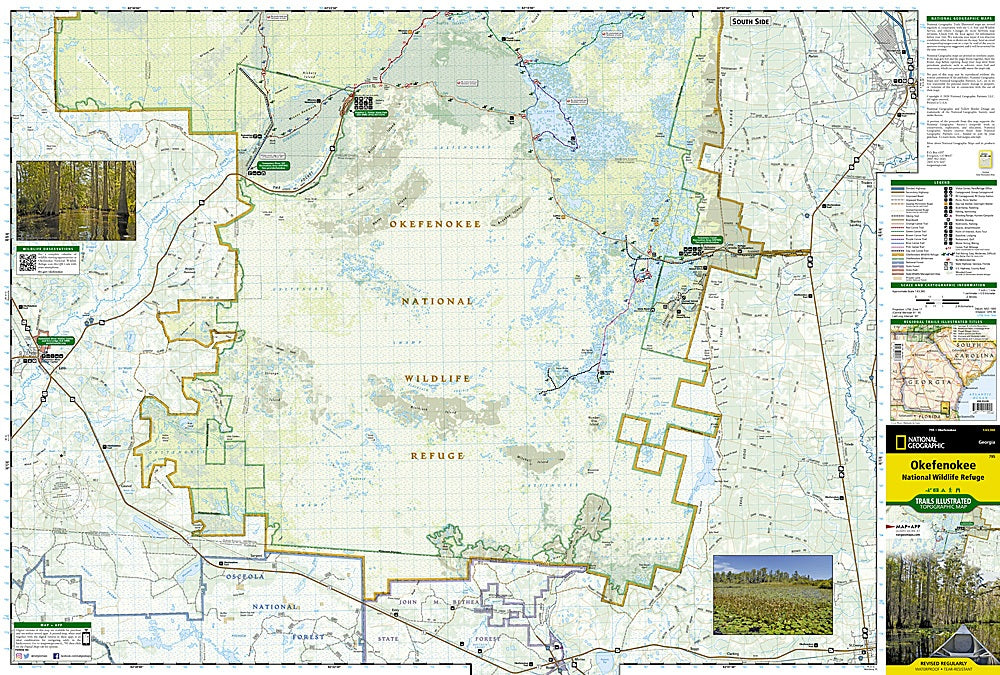
Okefenokee National Wildlife Refuge Trails Illustrated Topo Map #795
Couldn't load pickup availability
Share
Paddle, hike, or bike your way into one of America’s wildest frontiers with National Geographic’s Okefenokee National Wildlife Refuge Trails Illustrated Map #795! Covering over 630 square miles of southeastern Georgia’s legendary swamp country, this waterproof, tear-resistant map is your key to adventure through cypress forests, blackwater lakes, and endless boardwalks.
Discover must-see highlights like Stephen C. Foster State Park, the Okefenokee Swamp Park, and the scenic Suwannee River Sill Recreation Area. Navigate with confidence along canoe trails, backcountry boardwalks, and the Okefenokee Trail auto tour—all clearly marked with mileages, difficulty ratings, and recreation features.
Steeped in history, the Okefenokee (“Land of Trembling Earth”) has been home to Indigenous peoples and early settlers for centuries. Whether you’re spotting gators from your kayak or photographing sandhill cranes at sunrise, this map ensures you never miss a moment in one of Georgia’s most breathtaking wild landscapes.
SKU: SKU:TRA795
View full details