National Geographic
Ogden & Monte Cristo Range Trails Illustrated Topographic Map #700
Ogden & Monte Cristo Range Trails Illustrated Topographic Map #700
Couldn't load pickup availability
Share
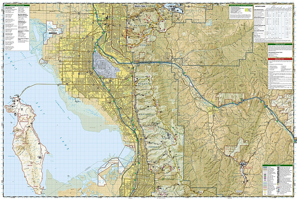
Get ready to lace up and explore northern Utah’s rugged playground with the Ogden & Monte Cristo Range Trails Illustrated Topographic Map #700 by National Geographic! Covering the scenic expanse east of the Great Salt Lake, this waterproof, tear-resistant map is your key to epic hikes and adventures.
Discover three of the region’s top attractions—Antelope Island’s roaming bison and panoramic views, the sparkling waters of Pineview Reservoir, and the winding trails of Cache and Wasatch National Forests. The area’s rich history dates back to the days of early trappers and pioneers who crossed the Wasatch Range, carving routes that now beckon today’s hikers, bikers, and campers.
With clearly marked trails (including sections of the legendary Great Western Trail), detailed elevation contours, and recreation features galore, this map is your go-anywhere guide to the mountains, forests, and wide-open beauty of Utah’s wild north.
SKU: SKU:TRA700
View full details