Freytag & Berndt
Norway North Cape Road Map by Freytag & Berndt
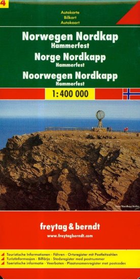
Norway North Cape Road Map by Freytag & Berndt
Couldn't load pickup availability
Share
Navigate Norway’s majestic northern frontier with the Freytag & Berndt Norway North Cape Road Map, scaled at 1:400,000. As Map 4 of 4 in the Norway series, it covers the awe-inspiring landscapes of Finnmark and Troms, where epic coastal drives meet Arctic wonder. Visit the dramatic North Cape plateau, perched 1,000 feet above the Barents Sea, and witness the midnight sun in summer. Explore Alta’s prehistoric rock carvings, a UNESCO World Heritage Site, or journey to Hammerfest, one of the world’s northernmost towns, steeped in polar exploration history.
This folded road map includes an extensive place-name index and clearly marks primary and secondary roads, distances, railways, airports, and passenger ferry routes. Travelers will appreciate the icons for museums, campgrounds, historic sites, and scenic lookouts. Whether you're road-tripping in a campervan or venturing out by car, this map is your essential companion to Norway’s Arctic treasures and rugged natural beauty.
SKU: SKU:MAPFBNORNCAPE
View full details