1
/
of
1
Green Trails
North Skyline | Mid-Peninsula, CA Green Trails Map 1212S
North Skyline | Mid-Peninsula, CA Green Trails Map 1212S
Regular price
$14.00 USD
Regular price
Sale price
$14.00 USD
Unit price
/
per
Couldn't load pickup availability
Share
North Skyline | Mid-Peninsula, CA Green Trails Map 1212S
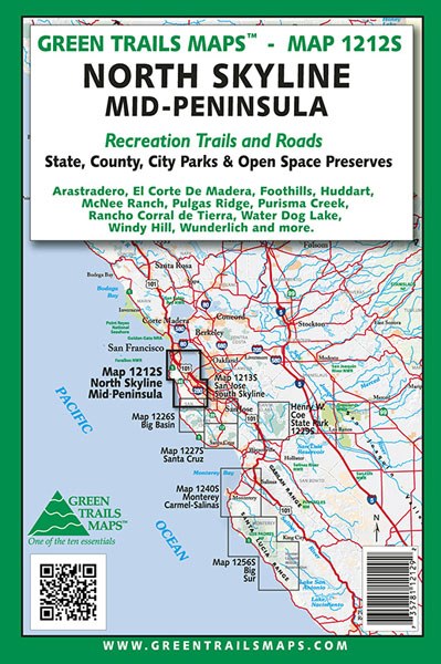
Original Edition 2012
Green Trails Maps show the most current trail, road, and access information to national forests, national parks, state and local parks and other public lands.
California's North Skyline and Mid-Peninsula area map. Printed on a rugged Waterproof Tear-Resistant Sheet.
Map Scale: 1:50,000 with inset of Pulgas Ridge O.S.P. and Edgewood County Park Area (1:18,000), Water Dog Park Area (1:18,000), Foothills Park and Arastradero Preserve Area (1:25,500) and Purisma Creek Redwoods Open Space Preserve, Huddart and Wunderlich County Park Area (1:25,500).
SKU: SKU:GRE1212S
View full details