SeaTrails
North Hood Canal, Dosewallips to Port Ludlow Paddling Map WA105
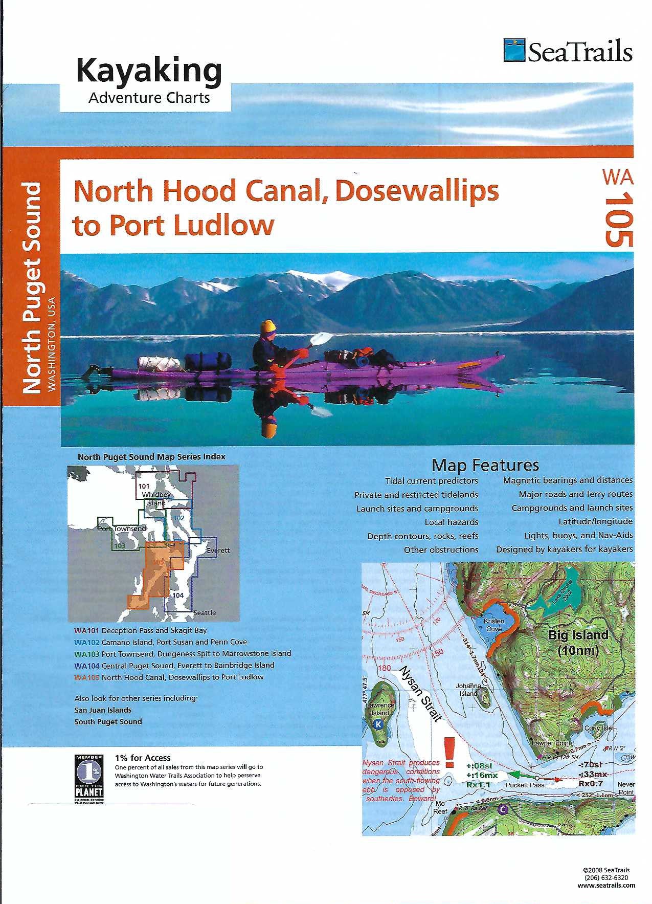
North Hood Canal, Dosewallips to Port Ludlow Paddling Map WA105
Couldn't load pickup availability
Share
Explore Washington’s scenic inland waters with the North Hood Canal, Dosewallips to Port Ludlow Kayaking Adventure Chart by SeaTrails. This detailed paddling map is tailored for sea kayakers, highlighting essential features like public launch points, campgrounds, navigational aids, and potential hazards.
Discover the peaceful beauty of Dosewallips State Park, glide past the historic Point Whitney Shellfish Lab, or stop at the charming marina in Port Ludlow. Shoreline distances and route bearings help with planning, while depth contours and buoy markers enhance safety.
Compact and waterproof, the chart fits perfectly on your kayak deck, keeping vital information close at hand. Whether you're paddling for a day or setting out on a multi-day journey, this chart is your trusted guide through one of Puget Sound’s most captivating stretches.
SKU: SKU:SEAWA105
View full details