Rand McNally
North Dakota & South Dakota State Highway Laminated Map Rand McNally
North Dakota & South Dakota State Highway Laminated Map Rand McNally
Couldn't load pickup availability
Share
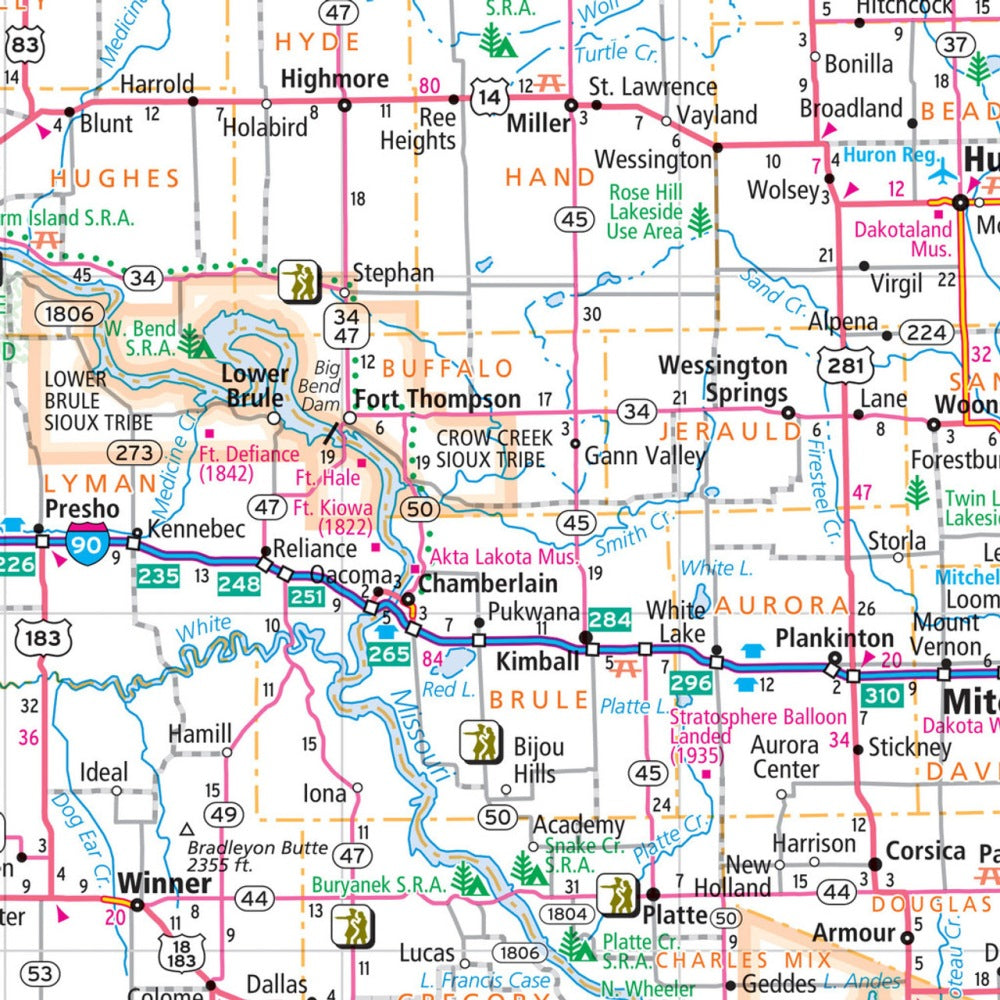
Unlock the Dakotas with a road-trip essential that grabs your attention from the moment you unfold it. The North Dakota & South Dakota State Highway Laminated Map by Rand McNally (Easy to Fold) gives travelers a clean, reliable, wipe-off surface—perfect for marking routes, jotting quick notes, and updating plans without smudges or tears.
Built with heavy-duty lamination, this map survives glove-box abuse, unpredictable weather, and countless refolds. It lays out full-color highway networks, county boundaries, points of interest, and clear cartography designed to keep you confidently oriented. The easy-fold format means no awkward wrestling with oversized sheets, and each section displays cleanly for fast reference.
Use it to plan mileage more efficiently—South Dakota alone spans roughly 380 miles east to west—and discover lesser-known gems like North Dakota’s enchanting Pembina Gorge, a must-see stop for scenic driving, hiking, and photography. Whether you’re a resident or just passing through, this map elevates every mile.
SKU: SKU:RMCUSNDE
View full details