National Geographic
North Cascades National Park Trails Illustrated Topographic Map #223
North Cascades National Park Trails Illustrated Topographic Map #223
Couldn't load pickup availability
Share
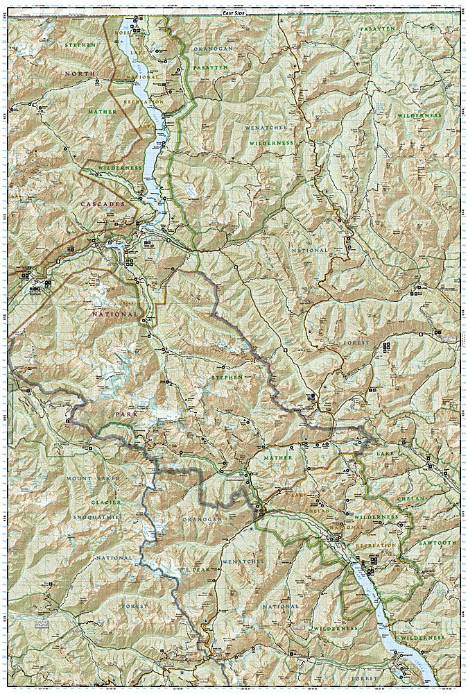
Get ready to tackle some of the most rugged and breathtaking wilderness in the Pacific Northwest with National Geographic's North Cascades Trails Illustrated Topographic Map #223! Perfect for hikers, backpackers, and adventure seekers, this map puts iconic peaks, glacial valleys, and sparkling alpine lakes right at your fingertips. Discover the stunning Baker Lake, wander through the wild beauty of Ross Lake National Recreation Area, and scale the dramatic heights of Mount Baker—all with confidence and ease.
Steeped in history, North Cascades National Park preserves a legacy of early mining, logging, and pioneering conservation efforts that shaped the region we enjoy today. This map covers over 500,000 acres of pristine wilderness, including the Pasayten and Stephen Mather Wilderness Areas, as well as key stretches of the Sauk, Skagit, and Suiattle Rivers. Trails are clearly marked with mileages, contour lines, and elevation details, making navigation simple whether you’re on the Pacific Crest Trail or exploring hidden side paths.
Printed on waterproof, tear-resistant paper and complete with a full UTM grid for GPS navigation, this Trails Illustrated map is your ultimate companion for epic hikes, backcountry adventures, and memories that last a lifetime. The North Cascades are calling—answer with confidence!
SKU: SKU:TRA223
View full details