National Geographic
North Cascades National Park Map
North Cascades National Park Map
Couldn't load pickup availability
Share
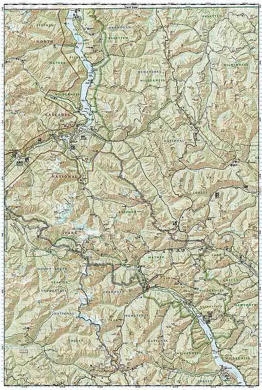
Embark on an unforgettable journey through the rugged wilderness of the North Cascades National Park with the expert guidance of this Trails Illustrated North Cascades National Park Hiking Map by National Geographic. This meticulously crafted map invites adventurers to explore the alpine forests, wild rivers, jagged peaks, and abundant glaciers that define this breathtaking landscape.
Created in collaboration with local land management agencies, including the Snoqualmie and Okanogan Wenatchee National Forests, this North Cascades National Park Hiking Map showcases key points of interest such as Baker Lake, Rockport State Park, and the Chelan and Ross Lake National Recreation Areas. It also covers the Stephen Mather, Mount Baker, and Pasayten Wilderness Areas, providing comprehensive coverage of this diverse region.
With miles of clearly marked trails, including segments of the Pacific Crest and Pacific Northwest trails, adventurers can navigate both well-trodden paths and remote backcountry routes with confidence. Detailed mileages between intersections, contour lines, and elevations for summits aid in trip planning and navigation, while helpful information on backcountry use, regulations, and recreational activities ensure a safe and enjoyable experience.