Rand McNally
North Carolina State Highway Laminated Map Rand McNally - Easy to Fold
North Carolina State Highway Laminated Map Rand McNally - Easy to Fold
Couldn't load pickup availability
Share
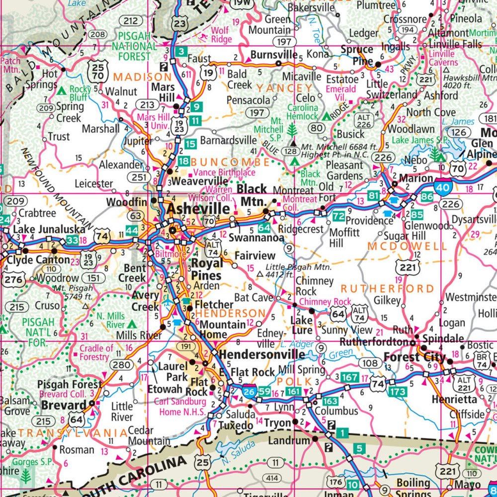
The North Carolina State Highway Laminated Map by Rand McNally hooks travelers instantly with its bright detail, wipe-clean surface, and effortless fold—perfect for anyone who refuses to let a weak signal derail a great road trip. Its laminated finish lets you trace routes, jot down notes, and erase them later, making it a practical, reusable planning tool from mountains to coast.
Designed to withstand miles of adventure, this Easy to Fold map highlights clearly marked highways, county lines, scenic routes, and can’t-miss attractions across the state. Travelers looking for hidden gems will love exploring the mystical beauty of Lake Mattamuskeet, a lesser-known wildlife haven that’s a standout detour for road-trippers. With North Carolina boasting roughly 78,000 miles of roadway, having a durable, tear-resistant map that folds into tidy sections helps you navigate it all with confidence.
A quick-reference legend and complete city index make this map a must-have for every glove compartment.
SKU: SKU:RMCUSNCE
View full details