National Geographic
North America Folded Reference Map with Flags by National Geographic
North America Folded Reference Map with Flags by National Geographic
Couldn't load pickup availability
Share
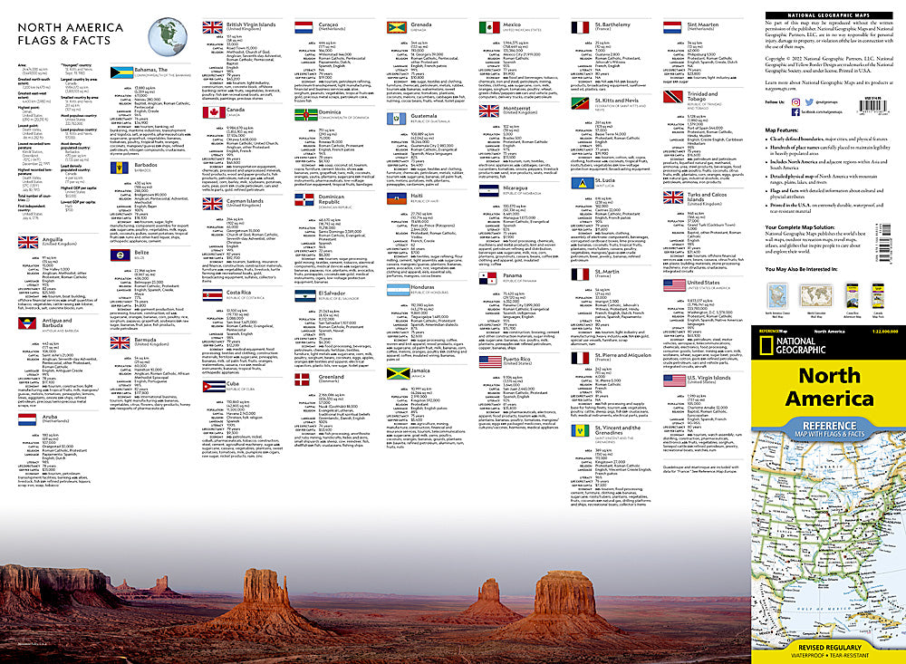
Discover North America like never before with the National Geographic North America Folded Reference Map with Flags & Facts! Perfect for travelers, students, and map enthusiasts, this map puts the continent at your fingertips with expert detail and a fun, easy-to-read layout. Explore both the political side, showing countries, major cities, and landmarks, and the physical side, highlighting mountains, rivers, plains, and lakes. From the Rockies to the Great Plains, the Mississippi to the Mackenzie, every landform is clearly labeled for quick reference.
North America Folded Reference Map with Flags & Facts points of interest include: the iconic Niagara Falls, the sweeping Rocky Mountains, and the historic city of Mexico City. Each country’s flag is paired with fascinating cultural and physical facts, making it a perfect companion for road trips, classroom learning, or global trivia nights. Printed in the U.S.A. on waterproof, tear-resistant synthetic paper, this map is built to travel with you anywhere — from backcountry adventures to cross-country road trips, it’s ready for whatever your journey brings.
SKU: SKU:TRA1300
View full details