1
/
of
1
NOAA
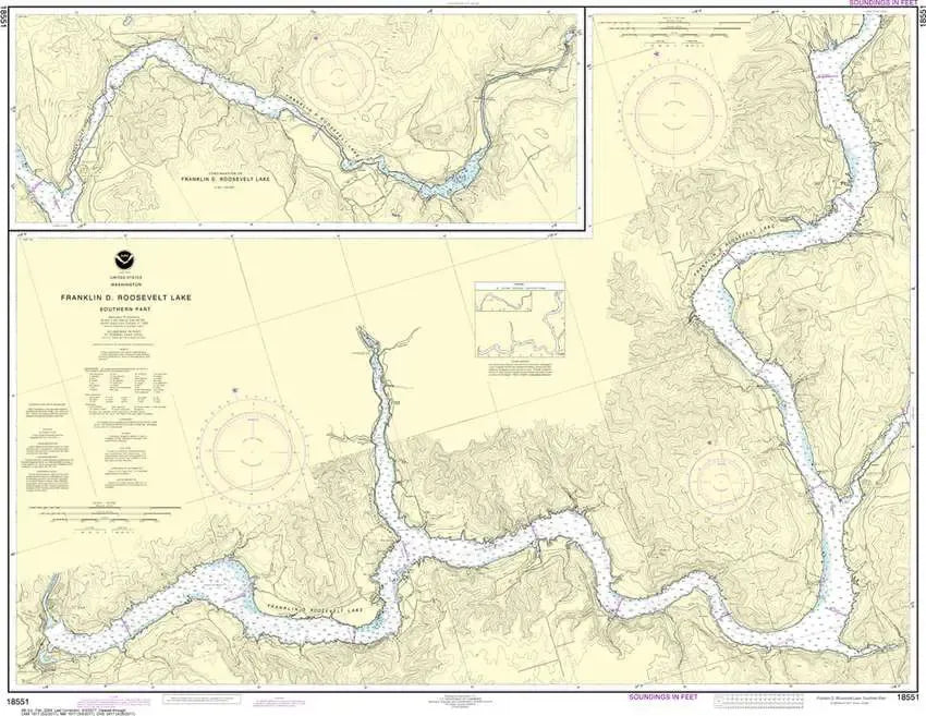
Nautical Chart 18551 - Franklin D. Roosevelt Lake South
Nautical Chart 18551 - Franklin D. Roosevelt Lake South
Regular price
$26.95 USD
Regular price
Sale price
$26.95 USD
Unit price
/
per
Couldn't load pickup availability
Share
Size/Scale: 1:50,000 | 47" x 36"
Nautical chart 18551 - Franklin D. Roosevelt Lake, South in Washington State. Shows from Coulee Dam to Nez Perce Creek including the Spokane River Arm.
It has all the features of an official navigation chart, but also makes a great, large wall map!
SKU: SKU:NOS18551
View full details