1
/
of
1
NOAA
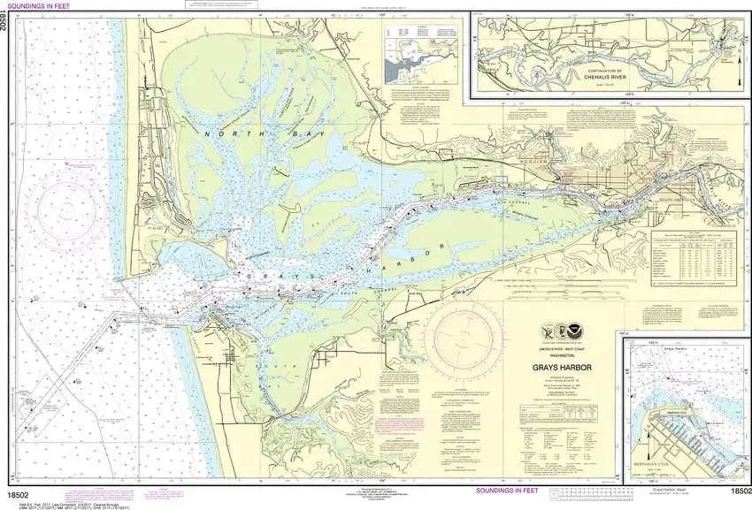
Nautical Chart 18502 - WA Coast - Grays Harbor
Nautical Chart 18502 - WA Coast - Grays Harbor
Regular price
$26.95 USD
Regular price
Sale price
$26.95 USD
Unit price
/
per
Couldn't load pickup availability
Share
Size/Scale: 1:40,000 | 41" x 28"
Nautical chart 18502 of Grays Harbor including Oceans Shores and Westport Official NOAA chart intended for navigation....Click here for a PDF image, and zoom in for a closer look at NOAA's Nautical Chart 18502 - Grays Harbor.
It has all the features of an official navigation chart, but also makes a great, large wall map!
SKU: SKU:NOS18502
View full details