1
/
of
1
NOAA
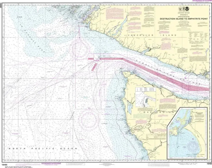
Nautical Chart 18480 - WA Coast - Approaches to Strait of Juan de Fuca
Nautical Chart 18480 - WA Coast - Approaches to Strait of Juan de Fuca
Regular price
$26.95 USD
Regular price
Sale price
$26.95 USD
Unit price
/
per
Couldn't load pickup availability
Share
Size/Scale: 1:176,253 | 35" x 42"
Nautical chart 18480 of the coast of Washington and part of Vancouver Island from Destruction Island to Amphitrite including Cape Flattery and the approaches to the Strait of Juan de Fuca. Detailed inset for the La Push area.
It has all the features of an official navigation chart, but also makes a great, large wall map!
SKU: SKU:NOS18480
View full details