1
/
of
1
NOAA
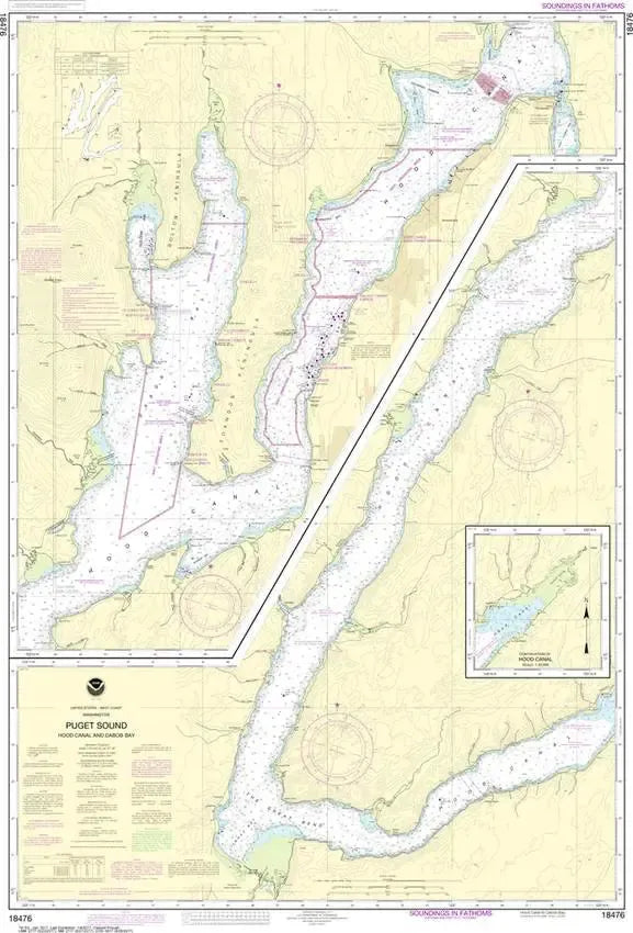
Nautical Chart 18476 - Hood Canal and Dabob Bay
Nautical Chart 18476 - Hood Canal and Dabob Bay
Regular price
$26.95 USD
Regular price
Sale price
$26.95 USD
Unit price
/
per
Couldn't load pickup availability
Share
Size/Scale: 1:40,000 | 35" x 47"
This nautical chart of the Puget Sound covers the Hood Canal from the "Great Bend" all the way to the Hood Canal Bridge and Port Gamble
It has all the features of an official navigation chart, but also makes a great, large wall map!
SKU: SKU:NOS18476
View full details