1
/
of
1
NOAA
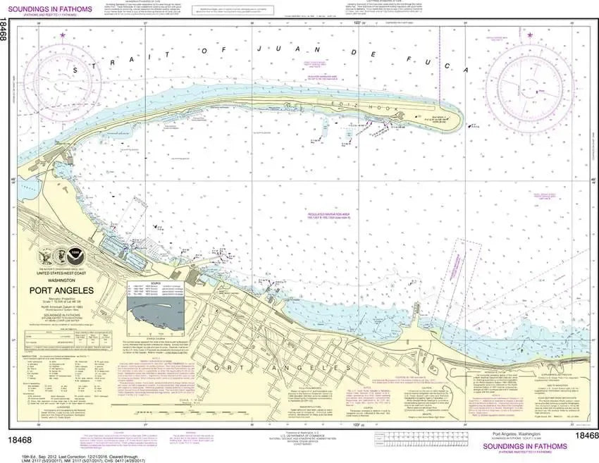
NOAA Chart 18468 - Port Angeles
NOAA Chart 18468 - Port Angeles
Regular price
$26.95 USD
Regular price
Sale price
$26.95 USD
Unit price
/
per
Couldn't load pickup availability
Share
Size/Scale: 1:10,000 | 32" x 24"
Nautical chart 18468 covering Port Angeles on the Strait of Juan De Fuca in detail.
It has all the features of an official navigation chart, but also makes a great, large wall map!
SKU: SKU:NOS18468
View full details