1
/
of
1
NOAA
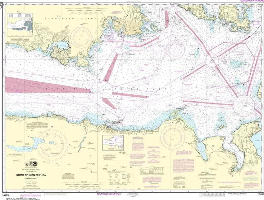
NOAA Chart 18465 - Strait of Juan de Fuca Eastern Part
NOAA Chart 18465 - Strait of Juan de Fuca Eastern Part
Regular price
$26.95 USD
Regular price
Sale price
$26.95 USD
Unit price
/
per
Couldn't load pickup availability
Share
Size/Scale: 1:80,000 | 47" x 35"
This nautical chart covers the waterways from Port Angeles to Port Townsend and across the Strait of Juan de Fuca to include Victoria, BC.
It has all the features of an official navigation chart, but also makes a great, large wall map!