1
/
of
1
NOAA
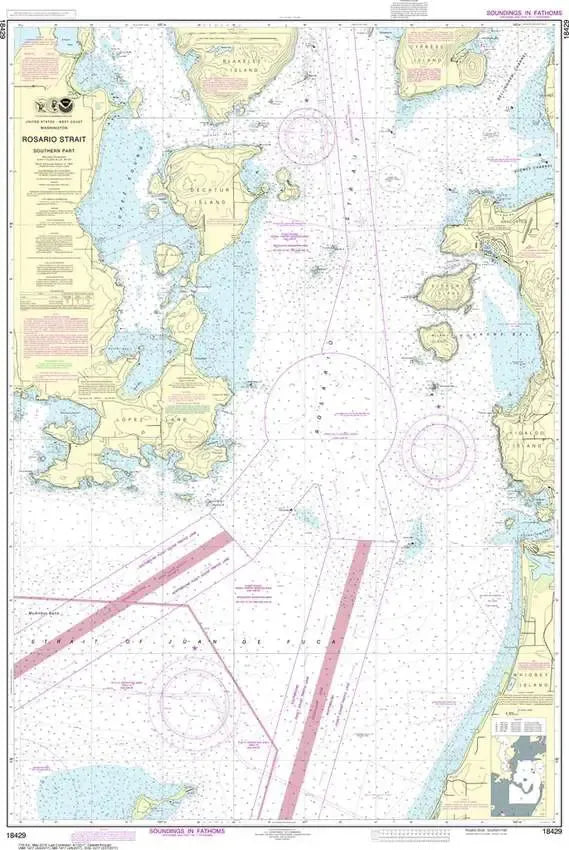
NOAA Chart 18429 - Rosario Strait, Southern Part
NOAA Chart 18429 - Rosario Strait, Southern Part
Regular price
$26.95 USD
Regular price
Sale price
$26.95 USD
Unit price
/
per
Couldn't load pickup availability
Share
Size/Scale: 1:25,000 | 35" x 48"
It has all the features of an official navigation chart, but also makes a great, large wall map!