National Geographic
New River Gorge National River Trails Illustrated Topographic Map #242
New River Gorge National River Trails Illustrated Topographic Map #242
Couldn't load pickup availability
Share
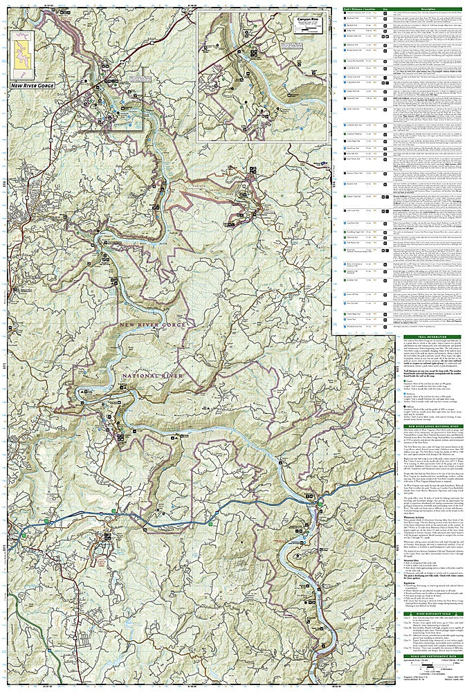
Discover one of America’s most breathtaking adventure playgrounds with National Geographic’s New River Gorge National River Trails Illustrated Topographic Map #242! Covering 53 miles of the mighty New River and 40 miles of its wild tributaries, this waterproof, tear-resistant map is your ticket to unforgettable hikes, climbs, and paddles through West Virginia’s scenic heart.
Explore top attractions like the towering New River Gorge Bridge, the lush trails of Babcock State Park, and the tranquil waters of Summerville Lake. History buffs will appreciate the preserved Civil War site at Carnifex Ferry Battlefield and the remnants of coal-era towns hidden among the cliffs.
Expertly researched with local land agencies, this map highlights Gauley River National Recreation Area and Bluestone National Scenic River with detailed trail summaries, distances, and recreation icons for campgrounds, whitewater launches, fishing spots, and more. Whether you’re hiking the Endless Wall, paddling whitewater rapids, or just chasing waterfalls, this map ensures your adventure never misses a beat.
SKU: SKU:TRA242
View full details