1
/
of
1
NOAA
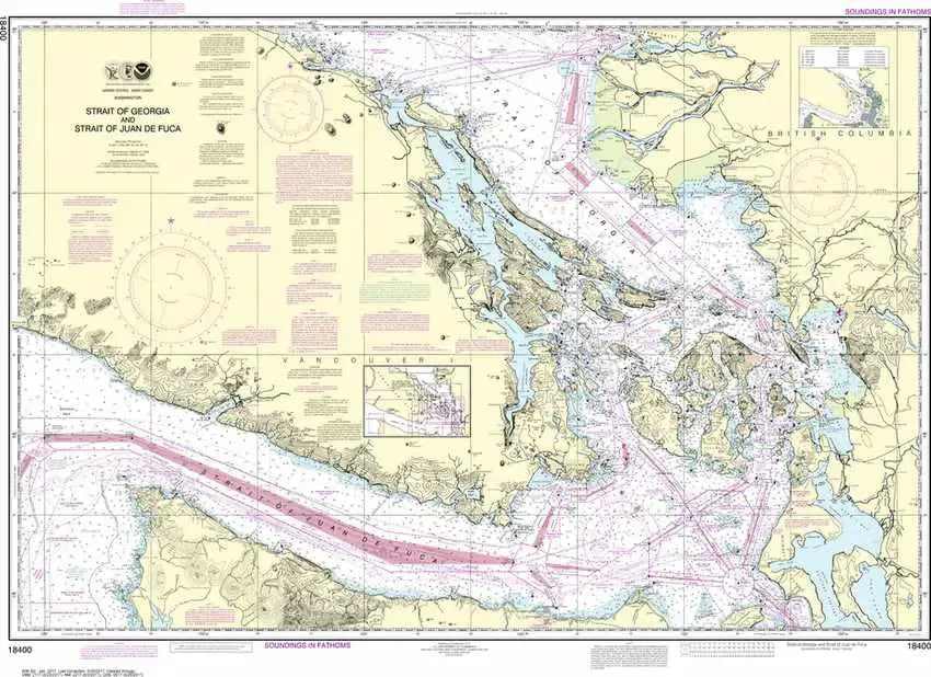
Nautical Chart 18400 - Straits of Georgia & Juan de Fuca
Nautical Chart 18400 - Straits of Georgia & Juan de Fuca
Regular price
$26.95 USD
Regular price
Sale price
$26.95 USD
Unit price
/
per
Couldn't load pickup availability
Share
Set sail through the legendary waters of the Strait of Georgia & Juan de Fuca—where every wave tells a story and every inlet invites exploration. This richly detailed Nautical Chart 18400 brings the Pacific Northwest to life, showcasing the Strait of Georgia, the Strait of Juan de Fuca, and the gateway San Juan Islands.
From bustling Victoria harbor routes to historic Indigenous Coast Salish and Captain Vancouver exploration corridors, this chart captures centuries of maritime history. Perfect for wall display or navigation reference, it measures 46" x 32" and features a 1:200,000 scale for impressive regional coverage and clarity. An essential chart for collectors, boaters, and coastal explorers seeking both beauty, accuracy, and timeless nautical navigation appeal everywhere now.
Please note: these charts are for decorative and reference only, to meet carriage requirements, vessels must carry official Electronic Navigational Charts (ENCs) in an electronic charting system, or utilize approved print-on-demand paper charts from certified agents.
SKU: SKU:NOS18400
View full details