1
/
of
1
NOAA
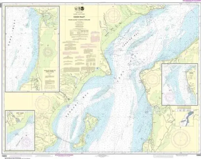
Nautical Chart 16662, Cook Inlet, Kalgin Island to North Foreland
Nautical Chart 16662, Cook Inlet, Kalgin Island to North Foreland
Regular price
$26.95 USD
Regular price
Sale price
$26.95 USD
Unit price
/
per
Couldn't load pickup availability
Share
Size/Scale: 1:100,000 | 45" x 36"
Nautical chart for central Cook Inlet along the west side of Kenai Peninsula. Includes Redoubt Bay, Kustatan, Kenai, Trading Bay, Nikiski and North Foreland. Official NOAA chart intended for navigation.