1
/
of
1
NOAA
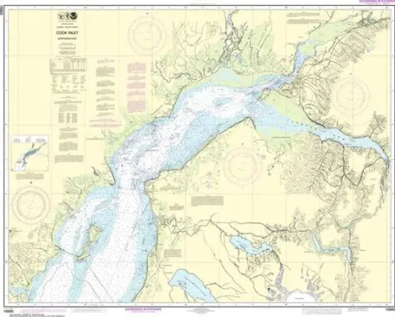
Nautical Chart 16661, Cook Inlet, Anchor Point
Nautical Chart 16661, Cook Inlet, Anchor Point
Regular price
$26.95 USD
Regular price
Sale price
$26.95 USD
Unit price
/
per
Couldn't load pickup availability
Share
Size/Scale: 1:194,154 | 44" x 36"
Nautical chart for northern Cook Inlet along the west side of Kenai Peninsula. Includes Kalgin Island, Redoubt Bay, Kenai, East Foreland, Trading Bay Fire Island, Turnagain Arm and Anchorage.
SKU: SKU:NOS16661
View full details