1
/
of
1
NOAA
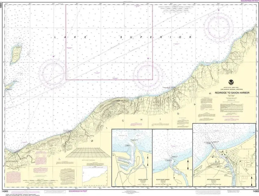
Nautical Chart 14965 (Lake Superior) Redridge to Saxon Harbor
Nautical Chart 14965 (Lake Superior) Redridge to Saxon Harbor
Regular price
$26.95 USD
Regular price
Sale price
$26.95 USD
Unit price
/
per
Couldn't load pickup availability
Share
Size/Scale: 1:120,000 | 47" x 35"
Nautical chart of part of Lake Superior including Beacon Hill, Sleeping Bay, Ontonagon, Black River Harbor and Saxon Harbor.
To the east is chart #14964
To the west is chart #14966
To the east is chart #14964
To the west is chart #14966
SKU: SKU:NOS14965
View full details