1
/
of
1
NOAA
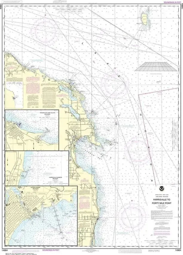
Nautical Chart 14864 (Lake Huron) Harrisville to Forty Mile Point
Nautical Chart 14864 (Lake Huron) Harrisville to Forty Mile Point
Regular price
$26.95 USD
Regular price
Sale price
$26.95 USD
Unit price
/
per
Couldn't load pickup availability
Share
Size/Scale: 1:120,000 | 34" x 49"
Nautical chart of Harrisville to Forty Mile Point in Lake Huron. Includes Harrisville Harbor, Alpena Harbor, Rogers City, Thunder Bay and Stoneport
To the south is chart #14863
To the northwest is chart #14880
Large, rolled up and full of detail...ideal for navigation or hanging on a wall!
SKU: SKU:NOS14864
View full details