1
/
of
1
NOAA
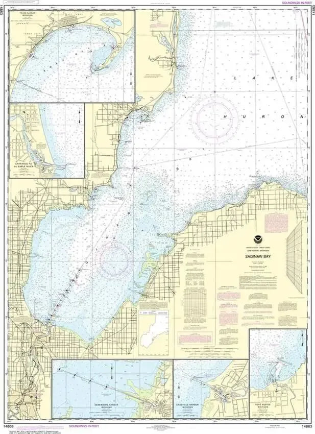
Nautical Chart 14863 (Lake Huron) Saginaw Bay
Nautical Chart 14863 (Lake Huron) Saginaw Bay
Regular price
$26.95 USD
Regular price
Sale price
$26.95 USD
Unit price
/
per
Couldn't load pickup availability
Share
Size/Scale: 1:120,000 | 35" x 47"
Nautical chart of Saginaw Bay in southern Lake Huron including Bay City, Caseville, Port Austin, Tawas Harbor and Oscoda.
To the north is chart #14864
To the southeast is chart #14862
Large, rolled up and full of detail...ideal for navigation or hanging on a wall!
SKU: SKU:NOS14863
View full details