1
/
of
1
NOAA
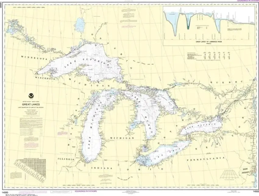
Nautical Chart 14500 - Great Lakes and Lake Champlain
Nautical Chart 14500 - Great Lakes and Lake Champlain
Regular price
$26.95 USD
Regular price
Sale price
$26.95 USD
Unit price
/
per
Couldn't load pickup availability
Share
Set your course across the legendary waters of the Great Lakes and Lake Champlain with this Nautical Chart 14500 that turns maritime heritage into wall worthy art. Spanning Lake Superior, Lake Erie, and the St. Lawrence Seaway, plus historic Lake Champlain, this chart captures iconic shipping routes and freshwater navigation at a glance.
Celebrate centuries of commerce and exploration, from French explorer Samuel de Champlain's early 17th-century voyages to modern Great Lakes freight corridors. Printed at a detailed scale of 1:1,500,000, this oversized chart measures 46" x 36" and delivers clear navigational context for boaters and map enthusiasts.
Please note: For decorative and reference purposes only, these charts are not intended for primary navigation; to meet carriage requirements, vessels must carry official Electronic Navigational Charts (ENCs) on an electronic charting system, or use approved print-on-demand paper charts from certified agents for compliant safe official navigation use only.
SKU: SKU:NOS14500
View full details