National Geographic
Nantahala & Cullasaja Gorges Trails Illustrated Topographic Map #785
Nantahala & Cullasaja Gorges Trails Illustrated Topographic Map #785
Couldn't load pickup availability
Share
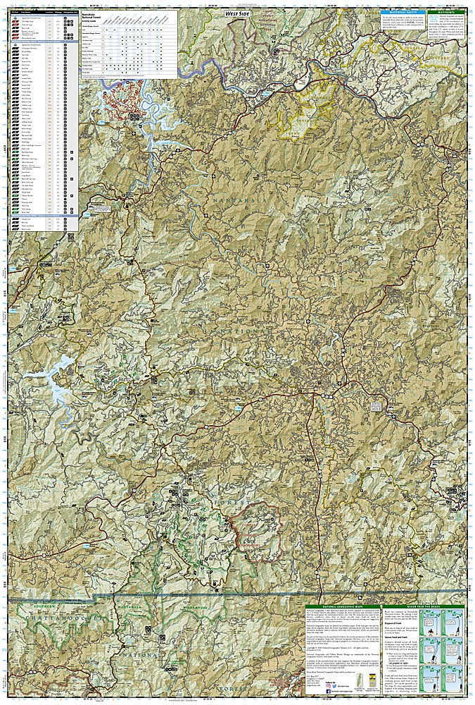
Get ready to explore some of North Carolina’s most breathtaking landscapes with National Geographic’s Nantahala & Cullasaja Gorges Trails Illustrated Topographic Map #785! Perfect for hikers, paddlers, and adventurers, this map puts the stunning Nantahala Gorge, Bridal Veil Falls, and the famous Cullasaja Falls right at your fingertips, along with thousands of acres of lush forest and winding trails.
Rich in history, the area was once traversed by the Cherokee people and later became a hub for early settlers seeking adventure in the Southern Appalachians. The map covers the eastern half of Nantahala National Forest in exquisite detail, highlighting the Appalachian, Bartram, Foothills, and Mountains-to-Sea Trails, plus scenic byways, overlooks, campgrounds, fishing spots, and whitewater access points. Trail charts show mileage, designated uses, and elevation changes, making planning a breeze.
Printed on waterproof, tear-resistant paper with a full UTM grid for GPS navigation, this map is your ultimate companion for safe, informed, and unforgettable outdoor exploration. Adventure is calling—answer it with confidence!
SKU: SKU:TRA785
View full details