National Geographic
Mt. Whitney Trails Illustrated Topographic Map #322
Mt. Whitney Trails Illustrated Topographic Map #322
Couldn't load pickup availability
Share
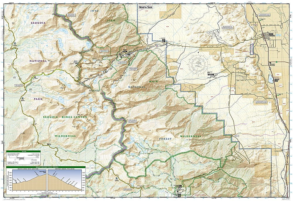
Conquer California’s tallest peak with confidence using the Mt. Whitney Trails Illustrated Topographic Map #322 by National Geographic! Whether you’re tackling the legendary Mount Whitney Trail, exploring the serene Cottonwood Lakes, or following the meandering South Fork Kern River, this map puts the region’s highlights right at your fingertips. Hikers will also love discovering the wonders of Sequoia, Kings Canyon, and Inyo National Parks, where towering forests, alpine meadows, and rugged granite peaks tell a story of California’s natural and human history.
This expertly crafted map covers every trail junction and contour, from the Pacific Crest Trail to the John Muir Trail, complete with mileage markers and a Mount Whitney trail profile showing altitude changes. Scenic byways, campgrounds, and recreation areas like boat launches and fishing spots are clearly marked, while safety tips and climbing advice help adventurers prepare for anything. Printed on waterproof, tear-resistant paper with a full UTM grid for GPS navigation, it’s the ultimate companion for off-trail exploration and high-altitude adventures. Discover the peaks, valleys, and history of California’s most iconic wilderness with confidence and ease.
SKU: SKU:TRA322
View full details