National Geographic
Mt Tamalpais & Point Reyes Trails Illustrated Topographic Map #266
Mt Tamalpais & Point Reyes Trails Illustrated Topographic Map #266
Couldn't load pickup availability
Share
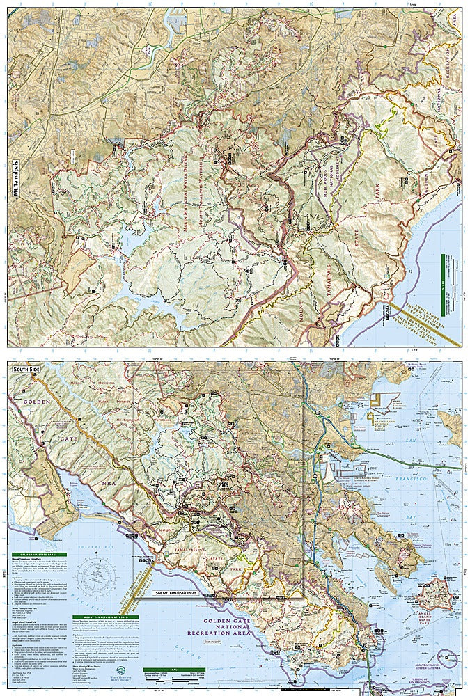
From redwood forests to rugged coastlines, this map is your ticket to adventure just north of San Francisco! National Geographic’s Mt. Tamalpais & Point Reyes Trails Illustrated Topographic Map #266 puts some of Northern California’s most iconic trails right at your fingertips. Hike through the misty groves of Muir Woods, soak in the panoramic views from Mount Tamalpais, or explore the windswept cliffs of Point Reyes National Seashore—all in one beautifully detailed, waterproof map.
Covering Marin County’s legendary outdoor playground, this map highlights the Bay Area Ridge and California Coastal Trails, as well as hidden gems like Tomales Bay and Samuel P. Taylor State Park. You’ll also find lighthouses, campgrounds, and wildlife-viewing areas perfect for weekend wanderers.
Steeped in history—from Coast Miwok homelands to 19th-century dairy farms—this area is a hiker’s paradise with stories in every ridge and ravine. Tear-resistant, GPS-ready, and trail-tested, it’s the ultimate companion for exploring California’s coastal wilds.
SKU: SKU:TRA266
View full details