National Geographic
Mt. Jefferson & Mt. Washington Trails Illustrated Topographic Map #819
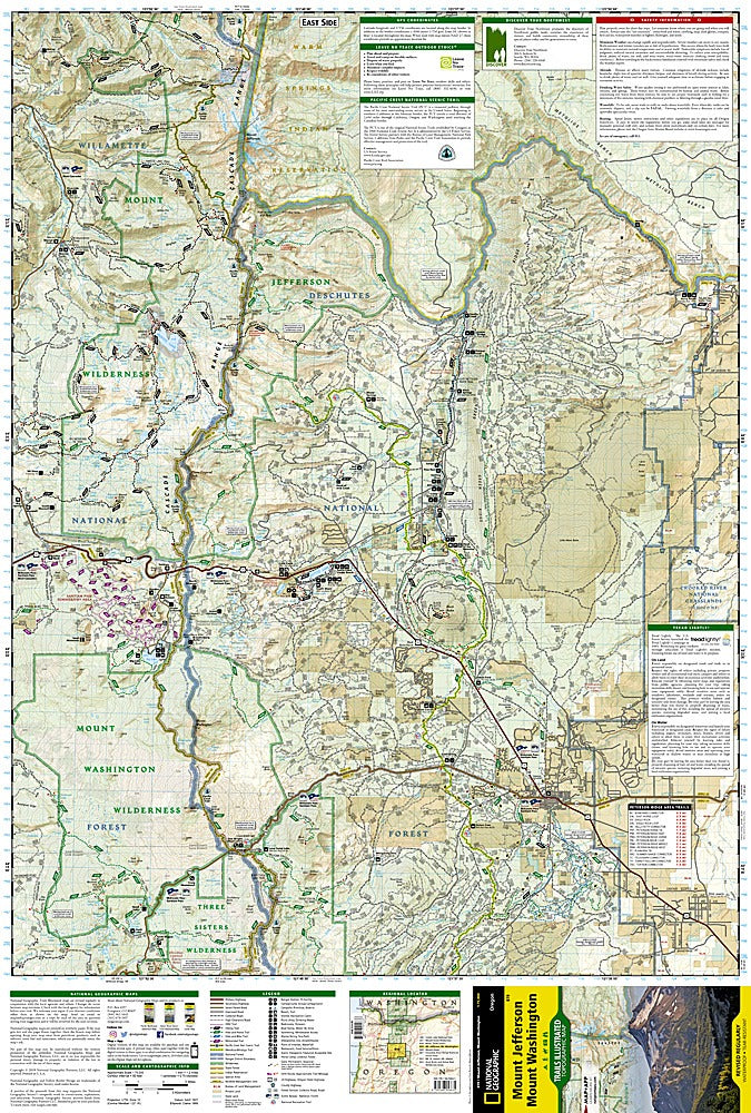
Mt. Jefferson & Mt. Washington Trails Illustrated Topographic Map #819
Couldn't load pickup availability
Share
Adventure calls in Oregon’s breathtaking High Cascades—home to glittering alpine lakes, volcanic peaks, and miles of untamed wilderness. The Mt. Jefferson & Mt. Washington Trails Illustrated Topographic Map #819 by National Geographic is your ultimate companion for exploring this rugged paradise. Covering both wilderness areas, this waterproof, tear-resistant map takes you deep into some of Oregon’s most iconic terrain, from the dramatic lava fields near McKenzie Pass to the serene waters of Suttle and Marion Lakes.
Discover top attractions like the awe-inspiring Pacific Crest National Scenic Trail, the crystal-blue Metolius River, and the scenic McKenzie Pass-Santiam Pass Byway. Hike through old-growth fir forests, traverse ancient volcanic ridges, or spot wildflowers in lush alpine meadows—all with confidence thanks to detailed trail markings, elevation contours, and GPS-friendly UTM grids.
Rich in history, this region was shaped by fiery eruptions and centuries of Indigenous travel routes, later becoming a haven for explorers and outdoor enthusiasts. Whether you’re backpacking, biking, or just chasing waterfalls, this map keeps your adventure on track and your spirit wild. Bring it along and let Oregon’s high country unfold one incredible trail at a time.
SKU: SKU:TRA819
View full details