National Geographic
Mt Hood & Willamette National Forests Trails Illustrated Topo Map #820
Mt Hood & Willamette National Forests Trails Illustrated Topo Map #820
Couldn't load pickup availability
Share
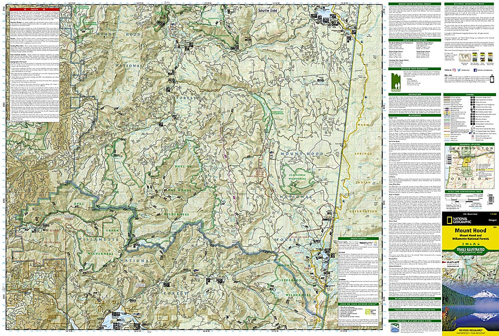
Towering above the Oregon landscape, Mount Hood’s glacier-capped peak calls to hikers, campers, and climbers from around the world—and this is the ultimate map to answer that call! The National Geographic Trails Illustrated Topographic Map #820 covers both the legendary Mount Hood and the sprawling Willamette National Forest, guiding adventurers through alpine lakes, lush valleys, and ancient volcanic landscapes.
Explore favorites like Timberline Lodge on the slopes of Mount Hood, the sparkling waters of Timothy Lake, or the secluded beauty of Olallie Lake Scenic Area. Step into history along the Oregon National Historic Trail, once a route for early pioneers, or follow the famed Pacific Crest Trail that winds through this breathtaking region.
Expertly researched with the U.S. Forest Service, this waterproof, tear-resistant map is packed with topographic details, trail mileage, recreation sites, and safety tips. Whether you’re snowshoeing to a backcountry hut, chasing waterfalls in Bull of the Woods Wilderness, or road-tripping the Mount Hood Scenic Byway, you’ll have the adventure of a lifetime right at your fingertips.
SKU: SKU:TRA820
View full details