National Geographic
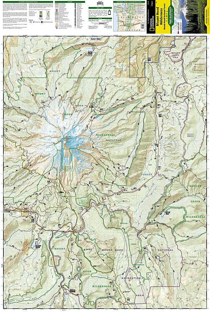
Mt. Hood Wilderness Trails Illustrated Topographic Hiking Map #321
Mt. Hood Wilderness Trails Illustrated Topographic Hiking Map #321
Couldn't load pickup availability
Share
Adventure calls from Oregon’s tallest peak! The Mt. Hood Wilderness Trails Illustrated Topographic Map #321 by National Geographic is your ultimate trail companion to one of the Pacific Northwest’s most breathtaking playgrounds. From the iconic Timberline Trail that circles the mountain to the rushing Sandy and Salmon Rivers and the panoramic vistas of Trillium Lake, this map leads you straight to the heart of Hood Country adventure.
Mount Hood’s story is as rich as its scenery—born of ancient volcanic forces and revered for centuries by Indigenous peoples, it’s now a haven for hikers, climbers, and dreamers. This detailed topographic map covers the Mount Hood Wilderness and National Forest, plus nearby gems like the Salmon-Huckleberry and Badger Creek Wilderness Areas, all marked with precise trail distances, elevations, and contour lines.
Waterproof, tear-resistant, and GPS-ready, this map is built for real trail life. Whether you’re chasing wildflowers, summiting glaciers, or finding the perfect campsite under the stars, you’ll have every trail, road, and river at your fingertips. Discover why Mount Hood remains Oregon’s crown jewel—and never lose your way while exploring it.
SKU: SKU:TRA321
View full details