National Geographic
Mt Dutton & Aquarius Plateau Trails Illustrated Topographic Map #705
Mt Dutton & Aquarius Plateau Trails Illustrated Topographic Map #705
Couldn't load pickup availability
Share
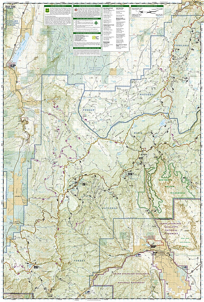
Adventure awaits on the trails of southern Utah with the Mt Dutton & Aquarius Plateau Trails Illustrated Topographic Map #705 by National Geographic. This hiker-friendly guide unlocks access to some of Utah’s most breathtaking landscapes, from the jagged Escalante Mountains to the sweeping heights of the Aquarius Plateau, the highest plateau in North America. Discover Red Canyon Recreation Area, where the Rim Trail winds past striking red sandstone cliffs and Greens Lake offers prime canoeing and trout fishing. Box-Death Hollow Wilderness thrills with its dramatic canyons carved by Escalante River tributaries, a place steeped in pioneer history and local lore. Otter Creek State Park provides a haven for birdwatchers, ATV enthusiasts, and anglers seeking high alpine trout.
Covering the Powell and Escalante Ranger Districts of Dixie National Forest, this map also highlights the Great Western Trail and the Fremont OHV Trail, perfect for hikers, bikers, and off-road adventurers alike. Printed on waterproof, tear-resistant paper with a full UTM grid for GPS navigation, this Trails Illustrated map is built to endure every outdoor escapade.
SKU: SKU:TRA705
View full details