

National Forest Service
Mt. Baker-Snoqualmie NF - Mt Baker Ranger District National Forest Map
Mt. Baker-Snoqualmie NF - Mt Baker Ranger District National Forest Map
Couldn't load pickup availability
Share
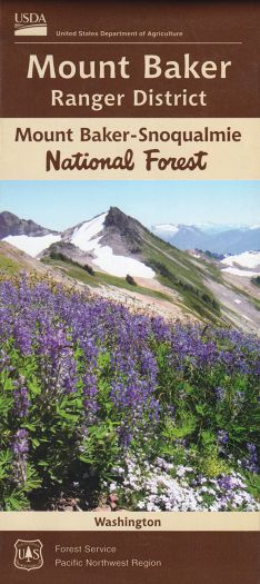
Discover the wild beauty of Washington’s North Cascades with the Mount Baker Ranger District Forest Service Map. Covering over one million acres of rugged alpine terrain within Mt. Baker-Snoqualmie National Forest, this detailed map is your gateway to adventure. Explore iconic spots like the Artist Point overlook, Heather Meadows, and the towering summit of Mount Baker itself. Ideal for hikers, climbers, and nature lovers, this map highlights trails, campgrounds, and backcountry access.
Located east of Bellingham near the Canadian border, the area is teeming with Douglas fir, western hemlock, black bears, marmots, and migratory songbirds. Rich in both Indigenous and pioneer history, the region offers a powerful connection to the Pacific Northwest’s past and present. Whether you’re trekking through wildflower meadows or planning your next summit, this Forest Service map is your perfect trail companion for discovering one of Washington’s most dramatic landscapes. Don’t just visit - experience Mount Baker.
SKU: SKU:NFWAMTBAKRD
View full details