Mitchell Geography
Mount Rainier Slope Aspect Reference Map & Poster
Mount Rainier Slope Aspect Reference Map & Poster
Couldn't load pickup availability
Share
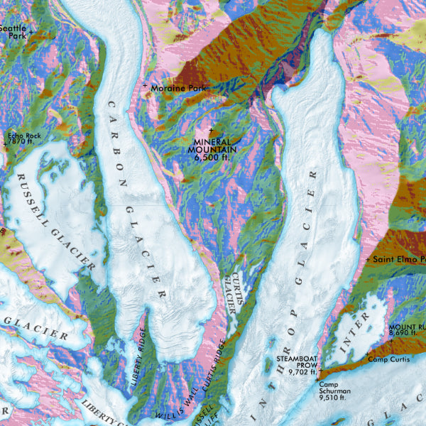
Turn your wall into a window on one of America’s most spectacular volcanoes. This Mount Rainier Slope Aspect Reference Map & Poster delivers science, adventure, and stunning design in one eye-catching piece.
Centered on Mount Rainier, this vibrant 13" x 19" poster showcases the mountain with brilliant color-shaded relief that reveals every ridge, glacier, and valley in remarkable detail. Using high-resolution 1-meter lidar data from the United States Geological Survey, the map highlights glaciers, summits, and surrounding terrain with exceptional clarity.
Slope aspect mapping shows the direction each slope faces—north, south, east, or west—which affects sunlight, snowpack, vegetation, and avalanche conditions. The result is a fascinating visual pattern that reveals the mountain’s terrain in a completely new way.
Located in Washington and towering over the Cascade Range, Rainier has drawn explorers and climbers for more than a century. Established in 1899, Mount Rainier National Park is one of America’s oldest national parks. Famous destinations like Paradise and Sunrise are clearly labeled.
Printed on heavy fine paper, this colorful map poster blends geography, science, and Pacific Northwest beauty into a striking display piece.
SKU: SKU:PMGWAMR02
View full details