Mitchell Geography
Mount Hood Slope Aspect Reference Map & Poster
Mount Hood Slope Aspect Reference Map & Poster
Couldn't load pickup availability
Share
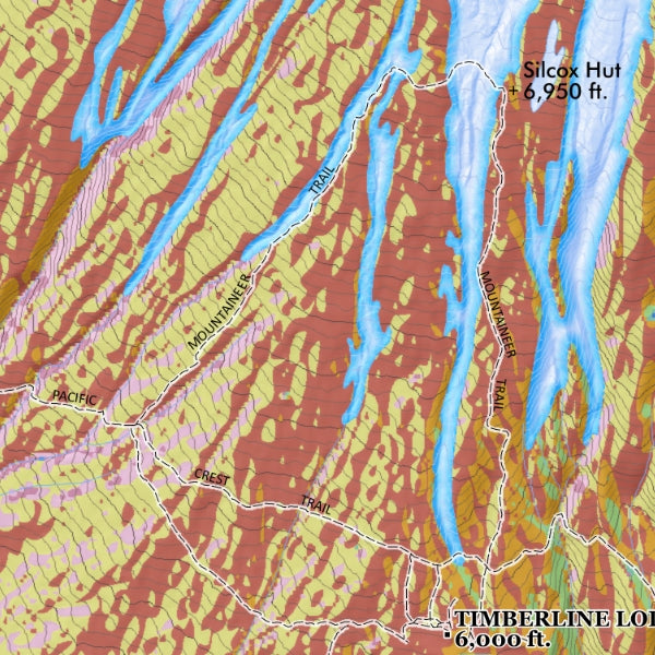
Towering above the Cascades with legendary alpine beauty, this Mount Hood Slope Aspect Reference Map is the perfect blend of adventure, science, and wall-worthy design. Whether you’re a skier, hiker, climber, or Pacific Northwest map lover, this striking 13" x 19" print brings Oregon’s most iconic peak to life in vivid detail.
Printed on heavy fine paper, this Mount Hood poster highlights slope aspect direction with an easy-to-read legend while labeling trail systems, terrain features, and key geographic landmarks. The map showcases the rugged volcanic landscape of Oregon’s highest mountain, a stratovolcano rising 11,249 feet above the Cascade Range. Originally formed through volcanic activity hundreds of thousands of years ago, Mount Hood has long served as both a cultural landmark and recreation hub for explorers and outdoor enthusiasts alike.
From the snowy slopes of Timberline Lodge to the scenic beauty of Trillium Lake, this eye-catching reference map sparks memories of epic adventures while adding a bold cartographic touch to any home, office, cabin, or gear room.
SKU: SKU:PMGORMH02
View full details