Green Trails
Mount Adams, WA - Green Trails Map 367S
Mount Adams, WA - Green Trails Map 367S
Couldn't load pickup availability
Share
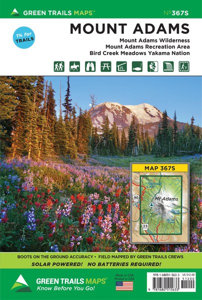
Mount Adams, WA - Green Trails Map #367S is an essential guide for exploring Washington’s second-highest peak. Offering rugged alpine beauty, Mount Adams rivals its more famous volcanic neighbors, Mount Rainier and Mount Hood. This 1:69,500 scale map covers nearly all of the Mount Adams Wilderness and the Yakama Nation Mount Adams Recreation Area, making it invaluable for those planning to summit the glacier-cloaked 12,276-foot peak.
It also highlights a key stretch of the Pacific Crest Trail from FR 23 to Muddy Fork Creek. Exceptional hikes featured include Bird Creek Meadows, the Round-the-Mountain Trail, Adams Creek Meadows, and Devils Garden. Equestrian trails near Gotchen Creek, Morrison Creek, and Snipes Mountain are also mapped, along with scenic trail networks around Horseshoe Lake, Chain of Lakes, and Takhlakh Lake.
ArticlesSKU: SKU:GRE367S
View full details