Benchmark
Montana Road & Recreation Atlas by Benchmark Maps
Montana Road & Recreation Atlas by Benchmark Maps
Couldn't load pickup availability
Share
Hit the trail with confidence and leave the guesswork behind with the Montana Road & Recreation Atlas by Benchmark Maps! Unlike relying on online maps that can lag, lose signal, or oversimplify terrain, this atlas puts every peak, valley, and backroad right at your fingertips—always accessible, always accurate. Perfect for hikers, campers, and outdoor explorers, it’s like having a local guide in your backpack.
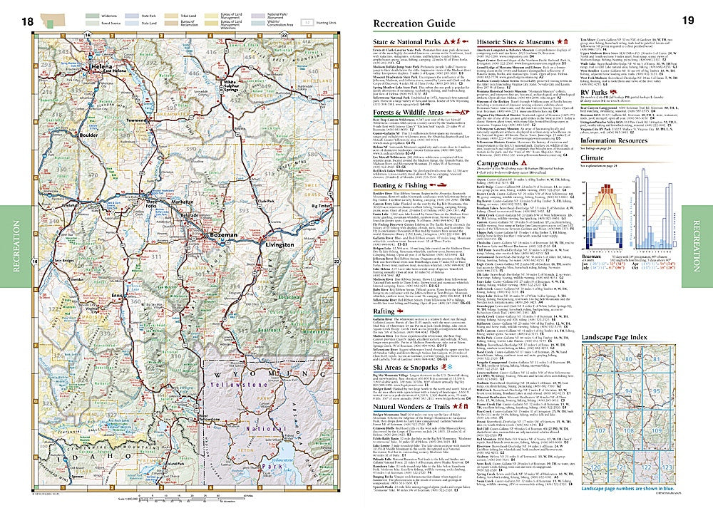
This atlas offers two distinct map styles to help you plan your adventure. The “Landscape” section shows elevation-tinted, shaded-relief maps so you can see mountains, valleys, and major roads at a glance, while the “Recreation” section color-codes public lands—BLM, National Forests, State Parks, wilderness areas, and more—for easy navigation of outdoor opportunities. High-resolution field-checked detail ensures you know exactly where private inholdings and land boundaries lie before you go.
With 128 pages at 1:250,000 and 1:800,000 scales, generous page overlap, GPS grids, and listings for campgrounds, scenic spots, RV parks, boat launches, hunting and fishing info, and golf courses, this 11” x 15” atlas is the ultimate companion for any Montana adventure.
SKU: SKU:NGSBENMTAT
View full details