National Geographic
Mojave National Preserve Trails Illustrated Topographic Map #256
Mojave National Preserve Trails Illustrated Topographic Map #256
Couldn't load pickup availability
Share
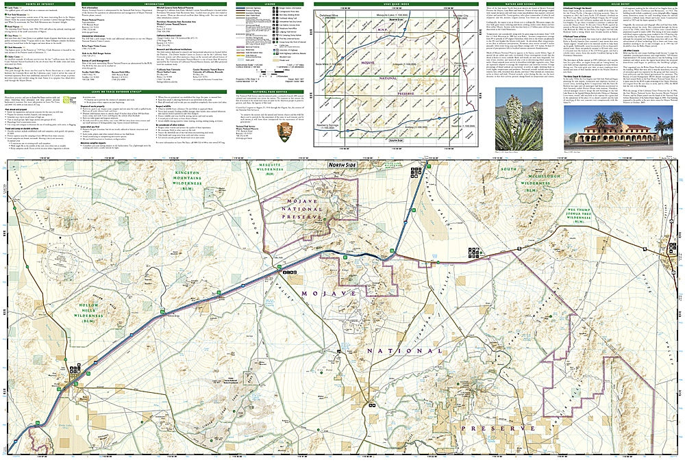
Where three great deserts collide, adventure begins! The Mojave National Preserve Trails Illustrated Topographic Map #256 by National Geographic is your ticket to one of America’s most fascinating desert landscapes—where towering dunes meet rugged mountains and hidden oases beckon explorers. Hike the Kelso Dunes for sweeping views of endless sand, wander through the volcanic cinder cones of the Cinder Cone Lava Beds, or venture deep into the surreal rock formations of Hole-in-the-Wall.
Covering the vast expanse between Barstow, Needles, and the Nevada border, this map reveals the heart of the Mojave’s wild beauty. Discover remnants of the Old Mojave Road, a historic wagon route once used by settlers and traders, and visit the restored Kelso Depot, a living tribute to the area’s railroad past.
Waterproof, tear-resistant, and packed with trail details, campgrounds, GPS grids, and local tips—this map is built for adventure. A must-have for hikers, backpackers, and desert wanderers alike!
SKU: SKU:TRA256
View full details