National Geographic
Mogollon Rim & Munds Mountain Trails Illustrated Topographic Map #855
Mogollon Rim & Munds Mountain Trails Illustrated Topographic Map #855
Couldn't load pickup availability
Share
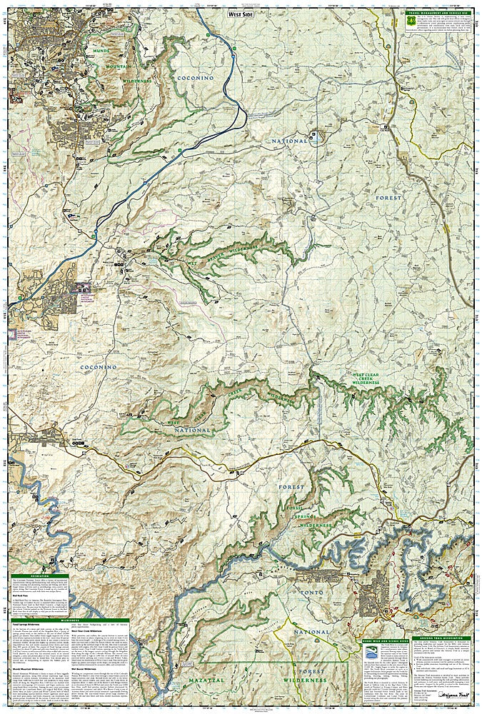
Discover the rugged beauty of central Arizona with the Mogollon Rim & Munds Mountain Trails Illustrated Map #855 by National Geographic—your ultimate hiking companion! From the striking red rocks of Munds Mountain to the sparkling pools at Wet Beaver Creek and the historic cliff dwellings of Montezuma Castle National Monument, this map puts adventure at your fingertips.
Covering the Tonto, Coconino, and Apache-Sitgreaves National Forests, the map highlights the Mogollon Plateau, Verde Wild and Scenic River, and the Mazatzal Wilderness, giving you a complete picture of the region’s topography and recreational gems. Follow trails like the Highline, General Crook, and Arizona Trail with confidence, aided by contour lines, elevations, labeled peaks, and clear trailhead markers. Forest Service roads, scenic viewpoints, campgrounds, swimming areas, and river access points are all pinpointed for your convenience.
Learn about the rich history of the area, including its Native American heritage and early settlers, while staying safe with included tips and contact info. Printed on waterproof, tear-resistant paper with a full UTM grid, this map ensures you’ll navigate confidently—rain or shine.
SKU: SKU:TRA855
View full details