National Geographic
Moab Greater Region Trails Illustrated Topographic Map #505
Moab Greater Region Trails Illustrated Topographic Map #505
Couldn't load pickup availability
Share
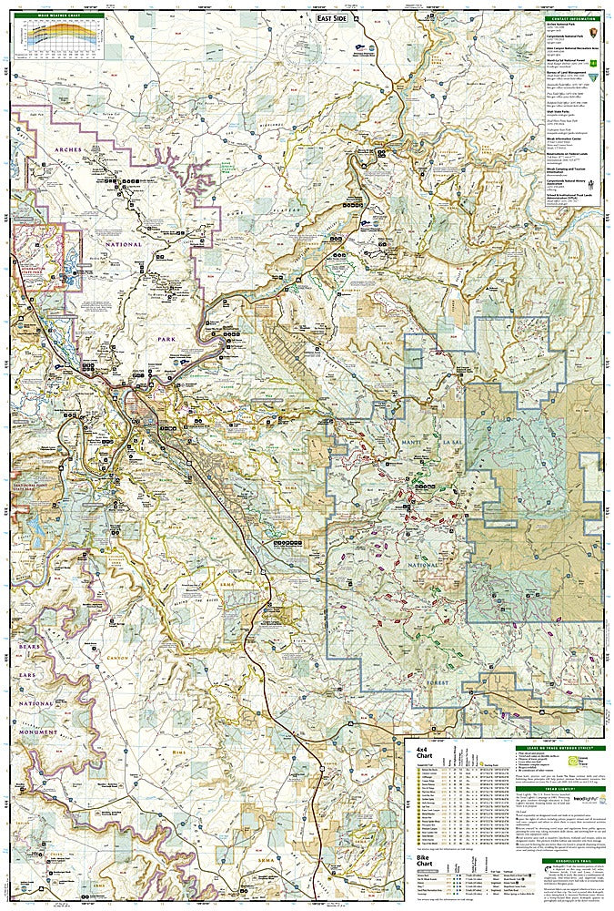
Adventure seekers, meet your ultimate desert companion! The Moab Greater Region Trails Illustrated Topographic Map #505 by National Geographic is your ticket to exploring Utah’s red rock wonderland—where slickrock rides, canyon hikes, and epic views await. Covering the heart of adventure country, this waterproof, tear-resistant map guides you through Arches National Park, Dead Horse Point State Park, and parts of Canyonlands National Park, plus the vast network of 4x4 and mountain bike trails that make Moab legendary.
Cruise the challenging Hell’s Revenge trail, tackle the world-famous Whole Enchilada ride, or hike among sandstone fins and ancient rock art left by the Ancestral Puebloans. Detailed topography, mileage between intersections, trail difficulty ratings, and Colorado River access points make it easy to plan your next route—whether you’re on foot, two wheels, or four. Designed with input from local experts, this rugged map keeps you confidently on track as you explore one of America’s most thrilling outdoor playgrounds.
SKU: SKU:TRA505
View full details