National Geographic
Moab Area West Trails Illustrated Topographic Map #506
Moab Area West Trails Illustrated Topographic Map #506
Couldn't load pickup availability
Share
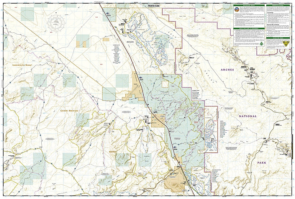
Adventure awaits in the red-rock wonderland of Moab! Whether you’re tackling the legendary Slickrock Trail, soaking in the sweeping vistas from Dead Horse Point State Park, or wandering among the surreal arches of Arches National Park, this map is your ultimate trail companion.
National Geographic’s Moab Area West Trails Illustrated Topographic Map #506 is tailor-made for hikers, mountain bikers, and off-road explorers ready to dive into Utah’s canyon country. Covering Moab’s most iconic trail systems—like Magnificent Seven, Klondike Bluffs, and Amasa Back—this map highlights every trail, road, and viewpoint with precision and easy-to-read detail.
Explore where ancient Ancestral Puebloans once roamed and cowboys carved rugged trails through slickrock canyons. Packed with trail distances, elevations, camping details, and river access points, it’s perfect for planning your next big adventure. Waterproof, tear-resistant, and GPS-ready, it’s built to survive every bump, splash, and climb Moab throws your way.
SKU: SKU:TRA506
View full details