National Geographic
Moab Area East Trails Illustrated Topographic Map #507
Moab Area East Trails Illustrated Topographic Map #507
Couldn't load pickup availability
Share
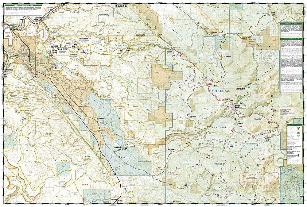
Where red rock cliffs meet blue sky adventure—Moab is the ultimate playground for outdoor lovers! The Moab Area East Trails Illustrated Topographic Map #507 by National Geographic is your go-to guide for exploring this legendary desert destination. Covering Arches National Park, Sand Flats Recreation Area, and the epic Slickrock and Whole Enchilada trails, this map helps you find every thrilling turn, climb, and overlook.
Discover where the Colorado River winds through ancient canyons once roamed by Ancestral Puebloans, or venture into the rugged terrain of the Manti-La Sal National Forest. Whether you’re mountain biking world-famous slickrock, hiking to Delicate Arch, or four-wheeling through Behind the Rocks, every route is clearly marked with trail use, distances, and elevation.
Built tough for desert conditions, this waterproof, tear-resistant map won’t quit when the dust kicks up. Designed with input from local experts, it’s your ticket to exploring Moab’s wild heart with confidence and style.
SKU: SKU:TRA507
View full details