National Geographic
Missoula & Mission Mountains Trails Illustrated Topographic Map #724
Missoula & Mission Mountains Trails Illustrated Topographic Map #724
Couldn't load pickup availability
Share
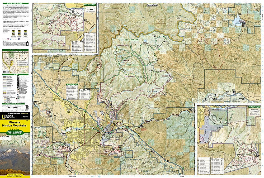
Discover the wild heart of western Montana with National Geographic’s Missoula & Mission Mountains Trails Illustrated Topographic Map #724. Covering the dramatic Mission Mountain Wilderness, Rattlesnake Wilderness, and Flathead National Forest, this waterproof, tear-resistant map is your ticket to endless backcountry adventure.
Explore iconic spots like Flathead Lake—the largest natural freshwater lake west of the Mississippi—Steely and Lindbergh Lakes’ pristine alpine waters, and the rugged Swan Range, home to elk, mountain goats, and sweeping valley views. This region has deep roots, once home to the Salish and Kootenai Tribes whose heritage still echoes through the landscape’s sacred peaks and valleys.
Perfect for hikers, bikers, paddlers, and campers, this map features detailed trail mileage, GPS grids, contour lines, and land management boundaries to keep your journey on track. Whether you’re climbing peaks near Missoula or trekking through tribal wilderness, this map ensures you’ll never lose your way in Montana’s magnificent wilds.
SKU: SKU:TRA724
View full details