1
/
of
2
National Geographic
Missoula, Mission Mountains Map
Missoula, Mission Mountains Map
Regular price
$11.95 USD
Regular price
Sale price
$11.95 USD
Unit price
/
per
Couldn't load pickup availability
Share
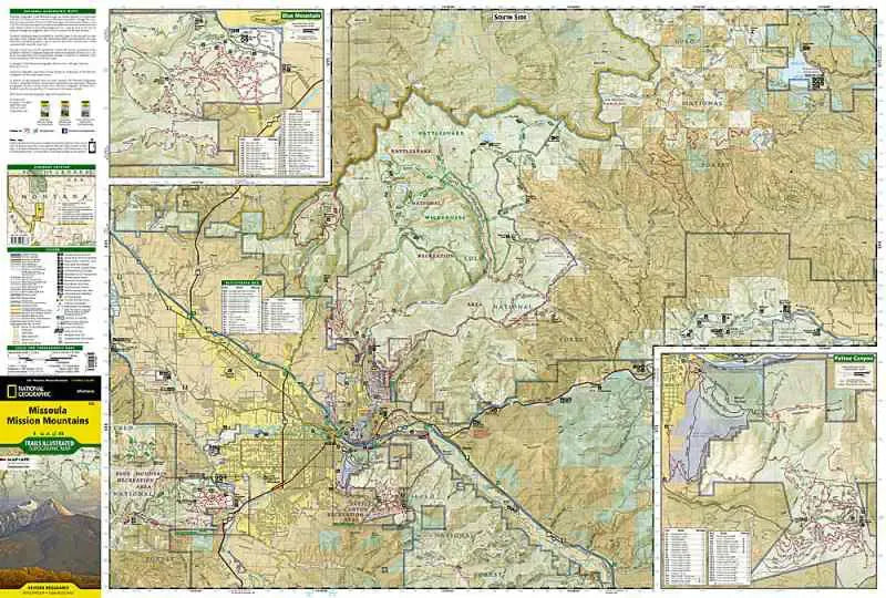
The Missoula Mission Mountains map covers the area immediately NE of Missoula, Montana. As close a 5 miles from the town center you can reach the Rattlesnake Wilderness and explore the trail network there. The flip side of the map shows the Mission Mountain Wilderness which is a narrow region with singular trails going in to various lake and ridges. Access roads from Route 83 through the Flathead National Forest are shown with road numbers and a snow mobile symbol for winter recreation. Also find insets for Pattee Canyon and Blue Mountain.
- 1" = 1.1 mile, 1 cm = .7 km
- waterproof
- Contour Interval 50 feet