Rand McNally
Michigan State Highway Folded Map by Rand McNally - Easy to Read
Michigan State Highway Folded Map by Rand McNally - Easy to Read
Couldn't load pickup availability
Share
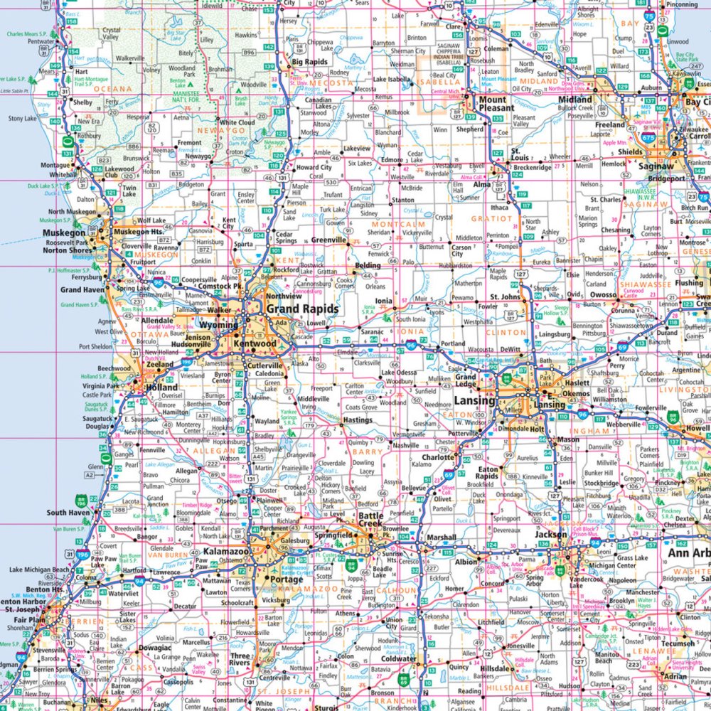
Hit the open road in the "Great Lakes State" with Rand McNally’s Easy to Read Michigan State Highway Map—your go-to travel buddy for exploring every scenic backroad and hidden gem! Ditch the unreliable cell signal and plan your perfect road trip the old-school way—with a real, full-color paper map that never needs charging.
This regularly updated folded map features all Interstate, U.S., state, and county highways, plus clearly marked parks, airports, and must-see attractions. The easy-to-use legend, detailed index, and larger type size make navigating Michigan’s winding routes effortless.
Whether you’re cruising the Lake Michigan shoreline, exploring vibrant Detroit, or discovering the fascinating Kitch-iti-kipi Spring—a crystal-clear hidden oasis in the Upper Peninsula—this map keeps you confidently on course. Durable, accurate, and designed for travelers who love the journey as much as the destination, Rand McNally makes every mile in Michigan unforgettable.
SKU: SKU:RMCUSMI
View full details